










GPS monitoring systems are gaining popularity every year. However, not everyone knows exactly how this tool functions. We have therefore decided to explain the intricacies of this subject in this article!
Basics of operation
The GPS tracking system uses the Global Navigation Satellite System (GNSS) network. This includes a series of satellites that use microwave signals transmitted to GPS devices to obtain information about location, vehicle speed, time, and direction. Thus, monitoring can potentially provide both real-time and archival navigation data during any type of journey.
Real-time tracking is also particularly useful from a security perspective, as it allows vehicle owners to determine the exact location of the vehicle at any given moment. Active in-vehicle tracking can then help the police determine where the vehicle was taken if it has been stolen.
Mobile phone/on-board computer tracking
Nowadays, mobile communication devices are becoming increasingly advanced and offer more than just the ability to make calls. GPS tracking of a mobile phone is an example of progress in this matter.
All mobile phones constantly transmit a radio signal, even when we are not using them to make calls. Telephone companies have been able to estimate the location of a mobile phone for many years by using triangulation information from signal-receiving towers. However, the introduction of GPS technology into mobile phones has allowed for much more precise estimation of these measurements.
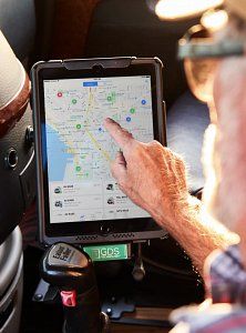 Source: https://www.verizonconnect.com/pl/
Location technology is based on measuring power levels and antenna patterns and uses the concept that a mobile phone always communicates wirelessly with one of the nearest base stations. Advanced systems determine the sector in which the mobile phone is located and also roughly estimate the distance to the base station. A further approximation can be achieved by interpolating signals between adjacent antenna towers. Qualified services can achieve an accuracy of up to 50 meters in urban areas where mobile traffic and the density of antenna towers (base stations) are sufficiently high. Rural and deserted areas may see kilometers between base stations, and therefore determine locations less accurately.
Network-based location system
Network techniques use the service provider’s network infrastructure to identify the location of a phone and an in-vehicle computer. The advantage of network-based techniques is that they can be deployed in a non-invasive manner, without negatively affecting the devices.
The accuracy of network-based techniques varies, with cell identification being the least accurate and triangulation being the most accurate. Many factors depend on the concentration of base stations, with urban environments achieving the highest possible accuracy.
Summary
We hope that we have managed to present at least some of the issues related to the functioning of the GPS monitoring system. This will allow those interested to become more familiar with this technology in detail and potentially use it themselves in the future!